(The Center Square) — Some climate scientists say the current Minnesota drought is only the beginning of a dour future while other meteorologists insist this is one of those normal swings in weather — not an inevitable hot trend.
The latest U.S. Drought Monitor was released Thursday morning. Minnesota’s prognosis worsened from the previous week.
All of Minnesota remains in drought, with the “extreme drought” category rising from 19% to 22% of the state. Droughts strike Minnesota about every 10 years.
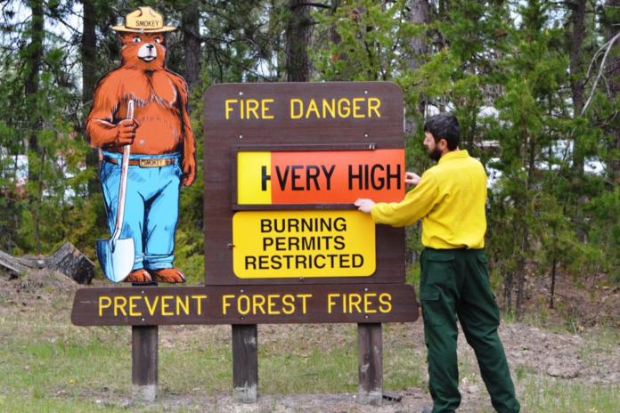
The drought is impacting citizens, especially farmers and businesses, throughout the state and particularly in counties in the northwest. Several areas have had to curtail drawing water out of rivers for home and business use. There are state cautions about increased fire danger.
Joe Bastardi, climatologist and co-proprietor of a commercial weather forecasting firm, WeatherBELL Analytics, describes the history of weather trends in Minnesota by looking at the averages.
“If we individually look at Minnesota summers since the big Dust Bowl era (1930s), they have averaged wetter than average overall. The nighttime lows are what has made it a bit above normal. Daytime highs have had no significant difference,” Bastardi told The Center Square.
Minnesota Public Radio reported the predictions of a hot, wet Minnesota seemingly contradicted the current drought extremes. Many climate experts have predicted major global warming, although actual observations have only shown modest increases.
MPR explained the contradiction: “So while Minnesota can expect to see warmer, wetter weather over time, it will also see these bursts of extreme weather. Think of it like a heated frying pan. If you put a little water in it, it will evaporate quickly — that’s drought. If you put a lot of water in it, it can boil violently — that’s severe storms.”
Bastardi said that analogy is scientifically “nonsense” and that extreme events are not increasing.
“How is it tornadoes are so low, hail is at record lows, and wind damage is way below average? It’s typical NPR [National Public Radio] simplification for the purpose of weaponization of weather,” he explained.
In addition, Bastardi said the public needs to realize that summer heat is a natural product of prevailing winds flowing eastward over the Pacific Ocean.
“Somebody gets hot and dry over the U.S. A lot of it depends on the pattern going on at the time in other areas, but someone is going to have a stretch of hot, dry weather. Why not — it’s downwind from the greatest source of planetary heat, the Pacific Ocean,” Bastardi explained.
Nevertheless the Minnesota Department of Natural Resources said the drought could end once heavy rains come. The department’s website states, “Under current conditions, it will take at least three to five inches of precipitation spread over a period of about two weeks to significantly alleviate drought.”
But even that hoped-for relief might not help farmers, ranchers, and local businesses that are already in danger of going out of business or suffering severe financial losses. The damage may have been done.
David Horn, retired Farm Bureau representative, lives in Hubbard County. He sees corn stunted but growing and soybeans somewhat holding their own.
“The sad part is some people who’ve been working 50-60 years, three or four generations, may be up against a wall,” he said.
Horn remembers the long, hot summer 45 years ago. “This year is probably worse than 1976.”
One difference is this time the dry conditions are more widespread geographically, Horn said. Back then, they could get hay from South Dakota or less affected areas of Minnesota.
Weather history does provide hope against fears of continuously warming temperatures. Most of Minnesota’s record monthly high temperatures are from 1950 or before.
Nine of the 12 monthly heat records fall in that category from the years 1896, 1910, 1917, 1931 (June and September), 1934, 1939, 1947, and 1950. No monthly record for highest temperature has even been tied for 34 years.
For Minnesota, Bastardi suggested looking at the overall weather history. For the fires, look at the 10-year average of acreage burned compared to this below-average year.
“You would never know it, would you?” he asked.


