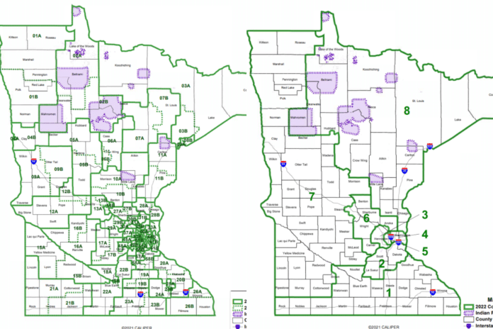
A judicial panel has finalized the boundaries that will shape Minnesota politics for the next 10 years.
The five judges appointed to a special panel by the Minnesota Supreme Court released the state’s new legislative and congressional maps Tuesday. The process, known as redistricting, happens every 10 years after the census and puts every legislative seat in the state up for grabs.
It also creates awkward scenarios, called “pairings,” wherein incumbents, often of the same party, are pitted against each other under the new boundaries.
“It’s a difficult conversation when members get paired together,” said Senate Majority Leader Jeremy Miller, R-Winona. “We do not pick winners and losers. We work with our members, but that is a decision each member has to make on their own.”
Miller said the maps “appear to be fair” but was disappointed to “see more Republican pairings compared to Democrat pairings.”
The job of drawing new maps is the responsibility of the Legislature but typically falls on the courts when the governor and legislative leaders can’t reach an agreement.
“When the legislature fails to exercise its constitutional authority, it is the role of the state courts to develop a valid legislative plan and order its adoption,” the panel of judges said in their order.
“Simply put, we are not positioned to draw entirely new legislative districts, as the legislature could choose to do. Rather, we start with the existing districts, changing them as necessary to remedy the constitutional defect by applying politically neutral redistricting principles. Still, this restrained approach does not necessarily yield little change. When one district changes, so must its neighbors — a cascading effect that means even a district drawn ten years ago that remains within appropriate population deviation will need to change along with the rest of the state,” they continued.
Redistricting is necessary to ensure that each district has the same number of people. The judicial panel explained it this way: “To remedy this constitutional defect, the legislative districts must be rebalanced so that they all contain substantially the same number of people; this ensures that each voter has equal power to select a representative.”
The redistricting process also reshapes the boundaries of all eight of Minnesota’s congressional districts. The First District, represented by Republican Rep. Jim Hagedorn, is a primarily rural district that “grew at a rate slower than the state as a whole.” This required the addition of 22,586 people, which was accomplished by moving Wabasha and Goodhue counties into the First.
These counties were moved out of the Second District, represented by Democratic Rep. Angie Craig. But her district now includes southern Woodbury and all of New Prague.
The Third District, represented by Democratic Rep. Dean Phillips, both contracted and expanded under the new maps. It no longer includes any of Carver County but added Hopkins, new portions of Edina, and Coon Rapids.
Rep. Betty McCollum’s St. Paul-based Fourth District lost the northern portion of Washington County, which is now in Republican Rep. Pete Stauber’s Eighth District. Like the Fourth, Rep. Ilhan Omar’s Fifth District was overpopulated, which was remedied by moving Hopkins and more of Edina into the Third.
Republican Rep. Tom Emmer’s Sixth District expanded on its southern end by “making the rapidly developing Carver County whole,” while Republican Rep. Michelle Fischbach’s Seventh District added the rest of Cottonwood County, all of Morrison and Wadena counties, more of Stearns County, and portions of Hubbard and Brown counties.
All of the news maps and explanations behind them can be viewed here.


